A 14-day southern Wild Atlantic Way campervan route from Karen & Co in Ballymoney, travelling to Kinsale and following the coast north through Cork, Kerry and Clare to Galway. Covers Mizen Head, Beara, the Ring of Kerry, Killarney, Dingle and the Cliffs of Moher, with scenic drives, coastal stops, overnight options and practical advice.
The southern Wild Atlantic Way begins among the colourful streets and sheltered harbour of Kinsale, then grows progressively wilder as it moves west.
Beyond the busy towns, the road follows long beaches, rocky headlands, mountain passes and peninsulas where distances can be deceptive. A drive that looks short on the map can easily fill half a day once viewpoints, narrow roads and unplanned coastal stops are added.
This guide starts and finishes at Karen & Co in Ballymoney. It allows 14 days for the full journey, including the long drive south, a slower exploration of Cork and Kerry, and a return north from Galway.
The route is divided into stages rather than fixed days. Spend longer where the weather is good, shorten a peninsula when conditions turn, and leave room for the places that were never part of the original plan.
This route is best suited to travellers who want more than a quick circuit of Ireland's headline attractions.
It works particularly well for:
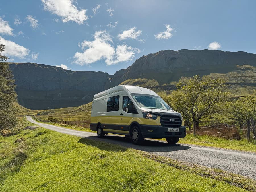
Because the route travels well beyond Northern Ireland and Donegal, choose one of Karen & Co's Premium campervans and confirm that the selected van is approved for the full journey.
New to travelling in a campervan? Read our campervan driving tips for beginners before setting out, including advice for narrow roads, parking and planning longer journeys.
The interactive southern Wild Atlantic Way map brings the complete route together in one place. Click the expand icon in the top right to open the full map, explore each route stage and use the marked stops to plan individual journeys in Google Maps.
Use the different layers to find:
Treat the map as a route planner rather than a schedule. The best approach is to choose one main destination for each day, then add smaller stops depending on the weather, traffic and time available.
Overnight arrangements can change seasonally. Always check current campsite availability, recent reviews and local signage before relying on a particular stop.
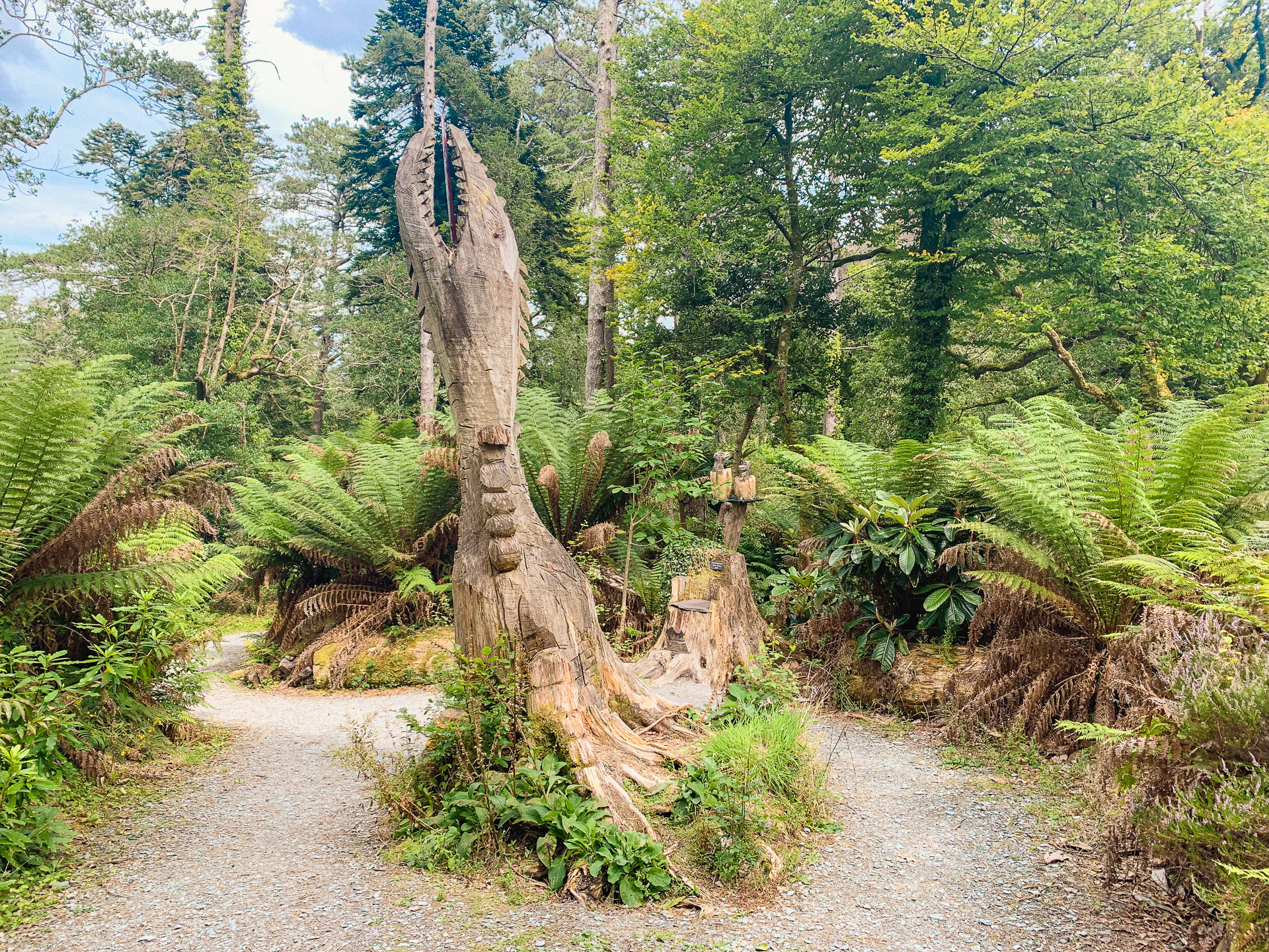
This is where the southern Wild Atlantic Way campervan route starts to come alive. These six highlights trace the journey from Kinsale and West Cork through Beara and Kerry to Dingle, West Clare and the Burren.
Together they show the variety of the route: colourful harbour towns, exposed headlands, mountain passes, gardens, beaches and dramatic Atlantic cliffs. Use this section to decide where you want to slow down, which stops best suit your interests and where weather or road conditions may shape the day.
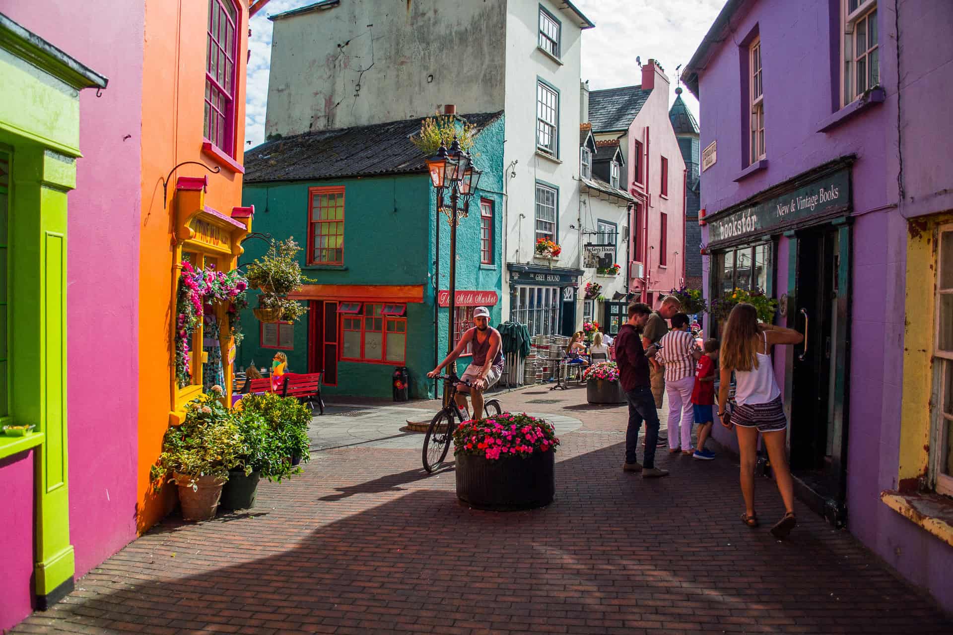
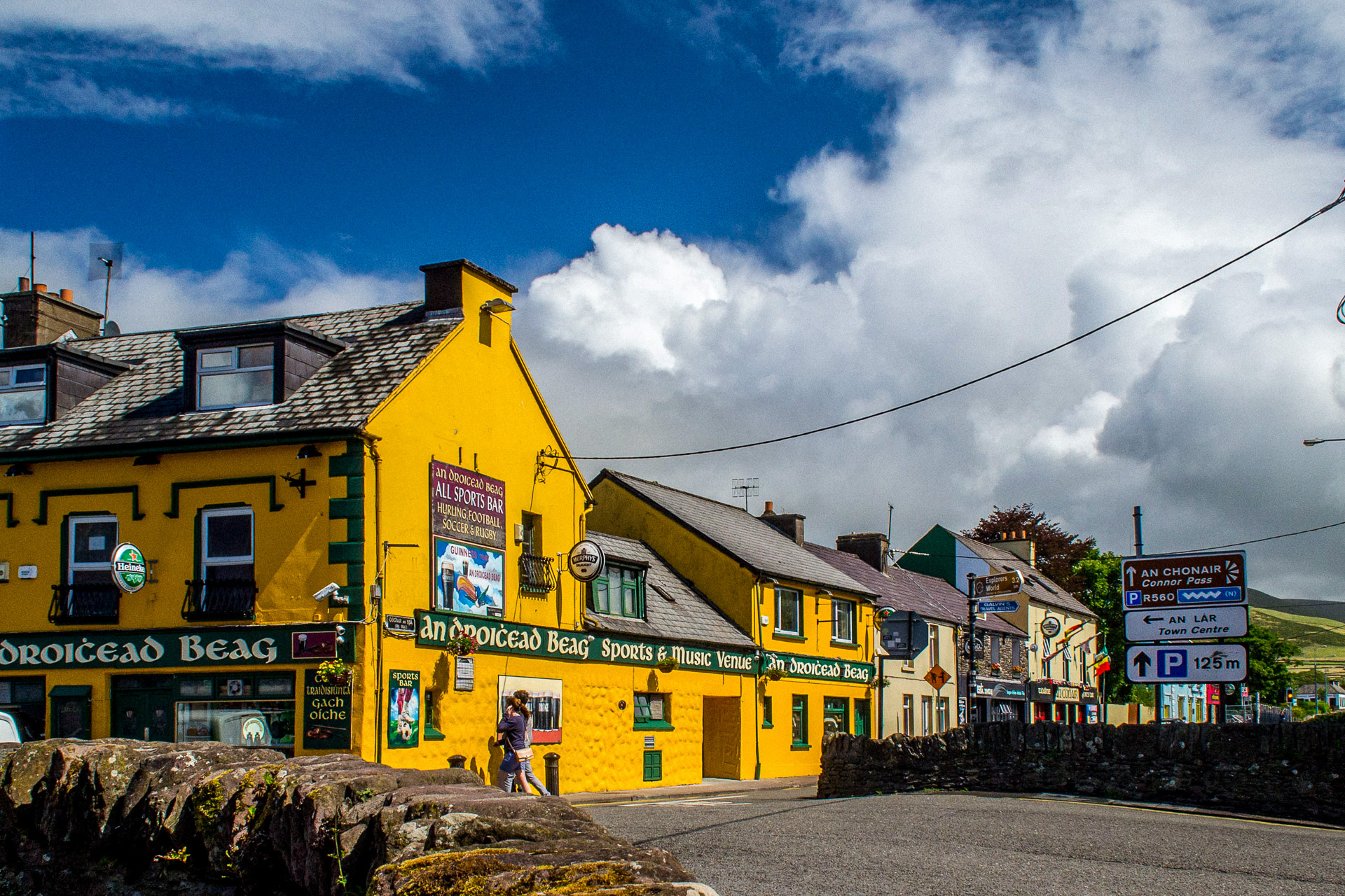
Kinsale is a gentle introduction to the route. Its compact centre, colourful buildings and working harbour are worth exploring on foot before the road begins to narrow farther west.
The Old Head of Kinsale adds the first real sense of Atlantic exposure, while nearby Garrettstown and Garrylucas provide beaches, coastal walks and a quieter place to end the day.
West Cork is a sequence of beaches, fishing villages and headlands rather than one single attraction.
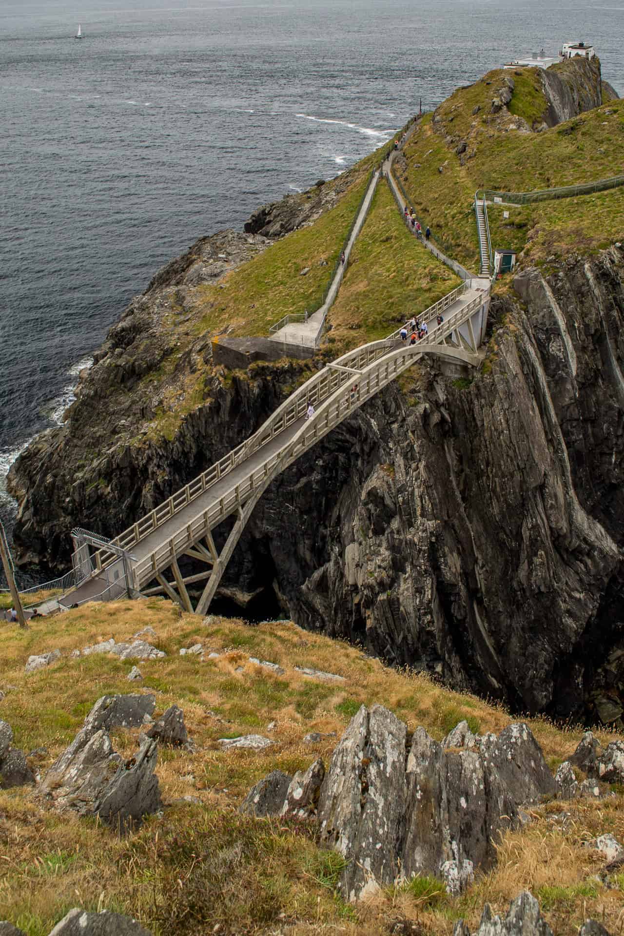
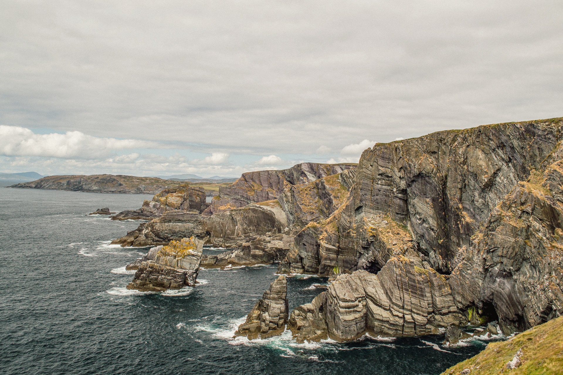
Long Strand makes an easy lunch stop, Crookhaven is worth a pause near the end of the peninsula, and Mizen Head deserves more time than a quick photograph. Reaching the main viewpoints involves steps, steep sections and exposed coastal paths.
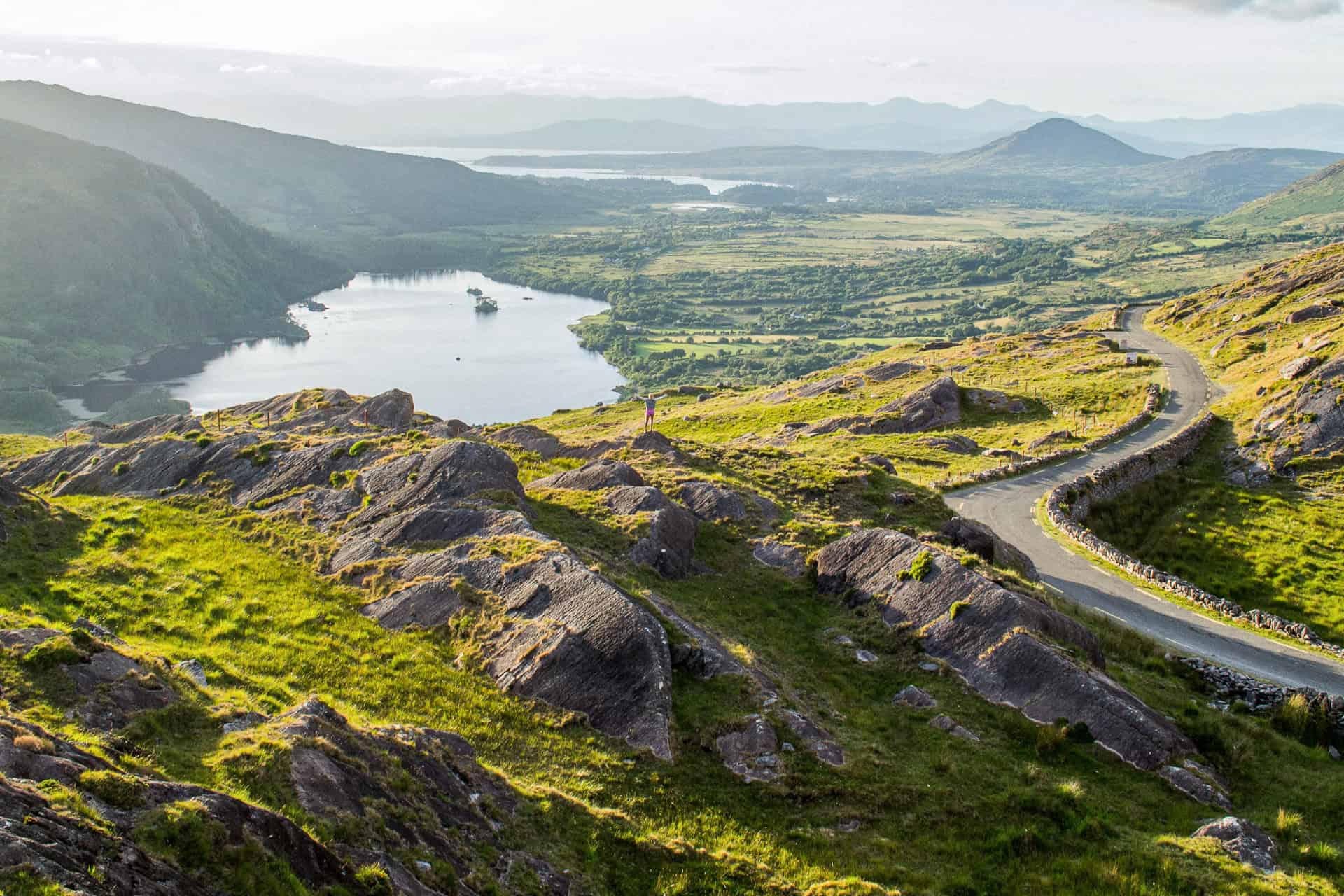
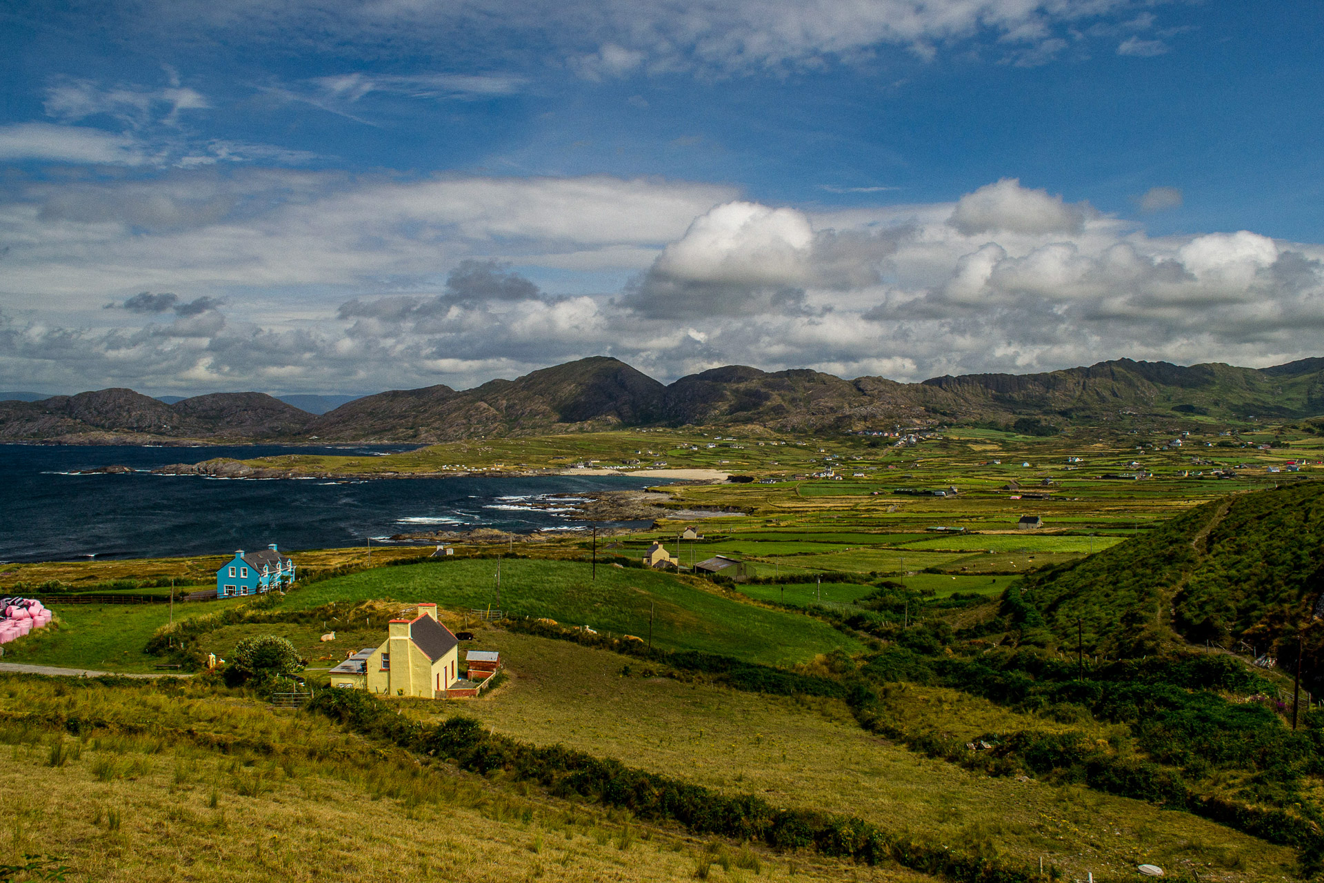
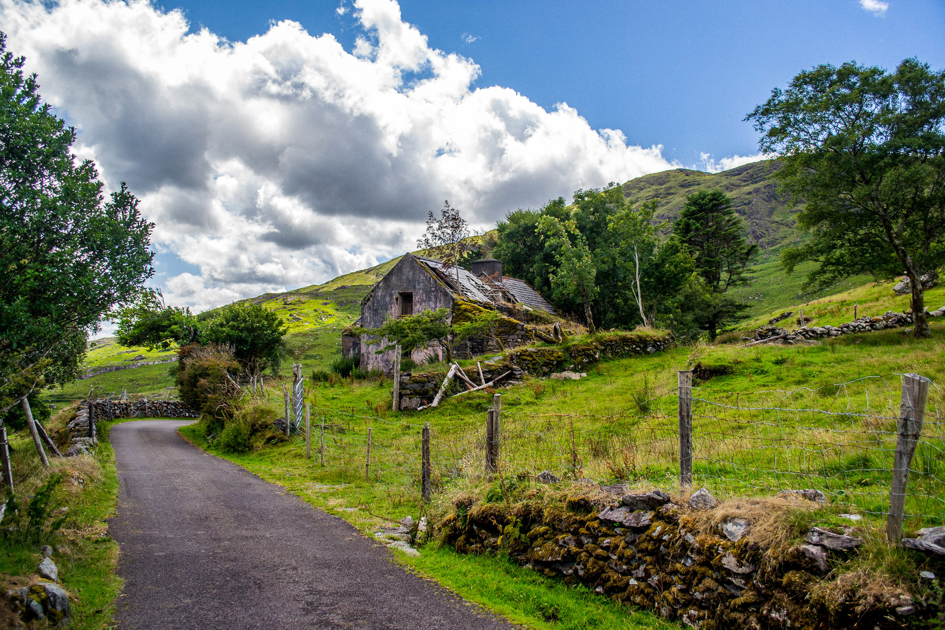
Beara feels quieter and more rugged than the better-known peninsulas farther north. That is part of its appeal.
The climb toward Healy Pass opens suddenly into mountain and valley views, while Glengarriff provides access to the gardens of Ilnacullin, also known as Garinish Island. Avoid trying to fit every narrow mountain road into the same day. Beara rewards patience.
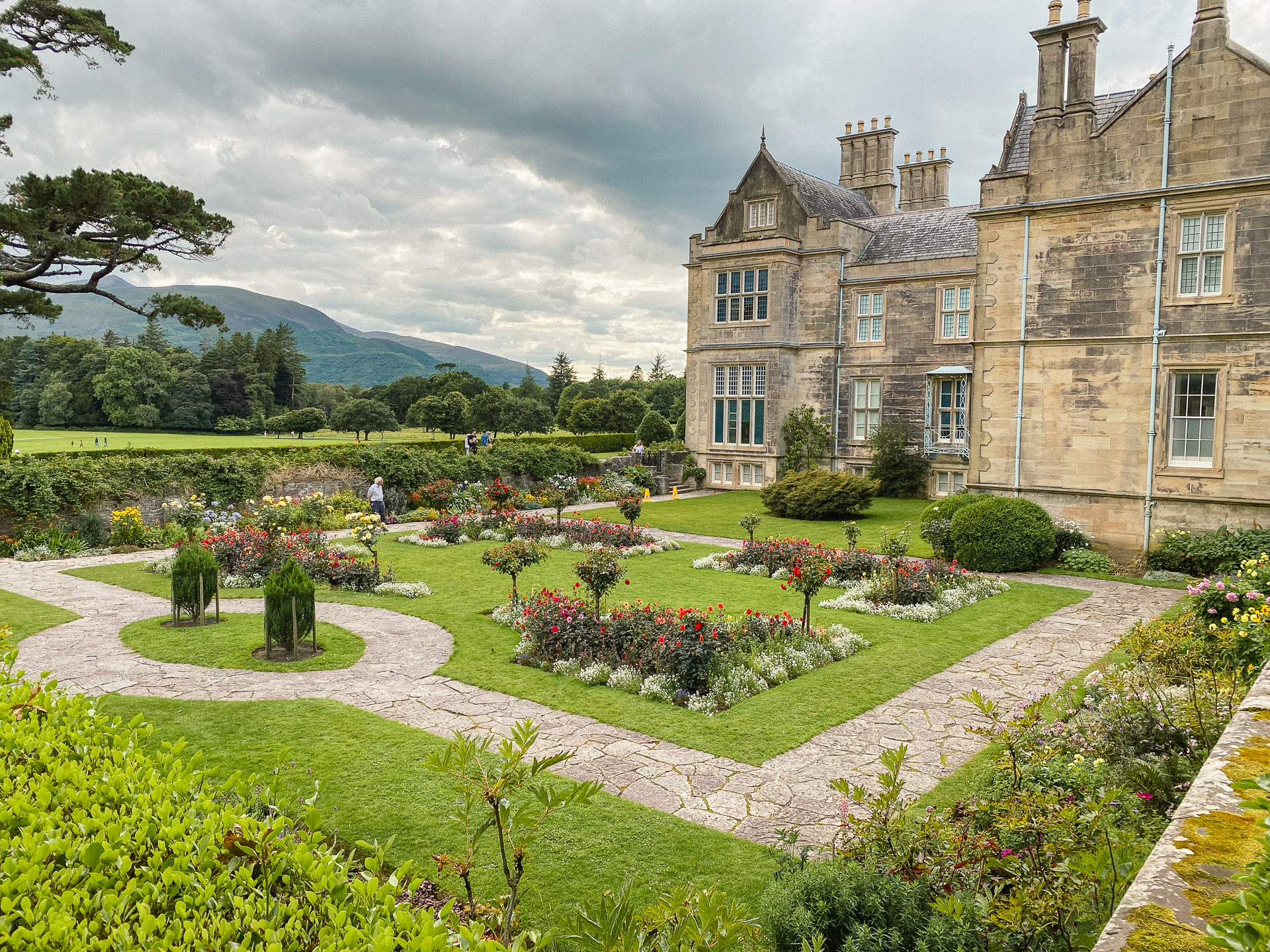
Killarney combines practical facilities with some of the route's most accessible scenery.
Muckross House, Torc Waterfall and the lakes can fill a day without moving the campervan far. After heavy rain, Torc is particularly impressive. The surrounding roads then lead toward the Ring of Kerry, Kells Bay and the open Atlantic coast.
Dingle packs beaches, mountain scenery, harbour life and exposed coastal drives into a relatively small area.
Inch Strand is the natural approach from the east, while Dingle town makes a useful base for the peninsula. Allow a full day for Slea Head Drive rather than treating the peninsula as a drive-through stage.
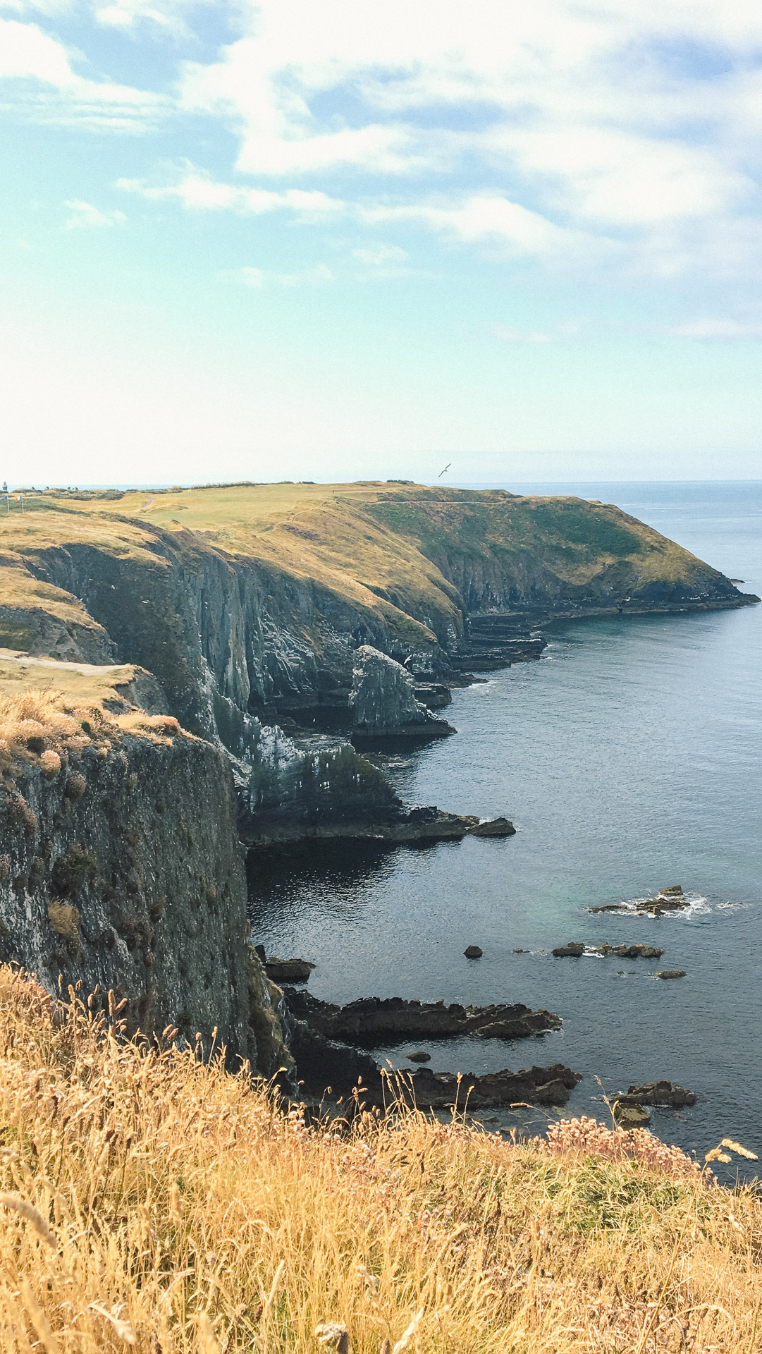
West Clare brings a noticeable change in landscape. Loop Head feels remote and understated, the Bridges of Ross reveal the force of the Atlantic, and the coast around Kilkee is worth exploring before continuing toward the Cliffs of Moher.
North of the cliffs, the green landscape gives way to the exposed limestone pavement of the Burren. Look closely and the seemingly bare rock reveals fissures, fossils and small pockets of plant life.
Thi campervan route guide is designed around a 14-day Karen & Co premium campervan hire, including the initial drive south and the journey home.
The nine stages below are regional sections, not individual days. Fourteen days gives enough time to slow down through West Cork, Kerry and Clare without turning every day into a long drive.
The opening stage is primarily a transfer south. With campervan collection at 2:30pm, it is better to divide the journey over two days rather than attempting to reach Kinsale that evening.
Choose between a faster route through Kilkenny or a more scenic route through County Wicklow.
The route normally crosses the barrier-free M50 toll. There is no toll booth, so the journey must be paid online by 8pm the following day.
Travel south past Belfast and Dublin before continuing towards Kilkenny. This is the more direct option and leaves a manageable journey to Kinsale the following day.
Nore Valley Park near Bennettsbridge provides a more scenic first-night stop than staying close to the motorway. Depending on your arrival time, you could also visit the Rock of Dunamase or spend the following morning exploring Kilkenny Castle and the Medieval Mile before continuing south.
For a slower and more scenic start, travel towards Rathdrum and stay at Hidden Valley Resort, set beside the Avonmore River.
The following morning, visit Glendalough for a lakeside walk or stop at Avondale Forest Park before continuing towards Kinsale. This route normally avoids the tolled section of the M50, although other road tolls may still apply.
The Wicklow option adds distance and includes narrower roads, so allow extra time and avoid rushing the narrower rural roads after dark.
Aim to reach Kinsale by early afternoon. Explore the colourful town centre and harbour before continuing towards the Old Head, Garrettstown or Garrylucas.
Scenic drives
Scenic stops
Walks, activities and beaches
Food and resupply
Overnight stops
Suggested overnight plan
Book established campsites in advance during busy periods. For informal or app-listed campervan stops, check recent reviews, local signage and current restrictions before staying.
Give Kinsale a proper morning rather than photographing the colourful streets and immediately leaving.
Explore the centre and harbour on foot, or follow the Scilly Walk towards Summercove and Charles Fort. The full walk is approximately 6km, so allow extra time if you plan to explore the fort before returning to the campervan.
From Kinsale, follow the coast towards the Old Head. This is the first stage where the journey begins to feel like the Wild Atlantic Way, with smaller roads, sea views and beaches appearing between the headlands.
Stop at the Lusitania Museum and Old Head Signal Tower for Atlantic views and the story of the passenger liner sunk offshore in 1915. Access beyond the entrance to the Old Head Golf Links is restricted, so do not plan to reach the lighthouse or the end of the headland unless an official public open day is taking place.
Continue towards Garrylucas and Garrettstown for a slower afternoon beside the coast. Both beaches work well for walking, surfing and relaxed family stops, even outside swimming weather.
If you stayed at Garrettstown House Holiday Park during Stage 1, keeping the same pitch for a second night avoids packing up and gives you a full day to explore the area.
Scenic drives
Scenic stops
Walks, activities and beaches
Food and resupply
Overnight stop
Suggested overnight plan
West Cork should be treated as a series of small experiences rather than a race to Mizen Head.
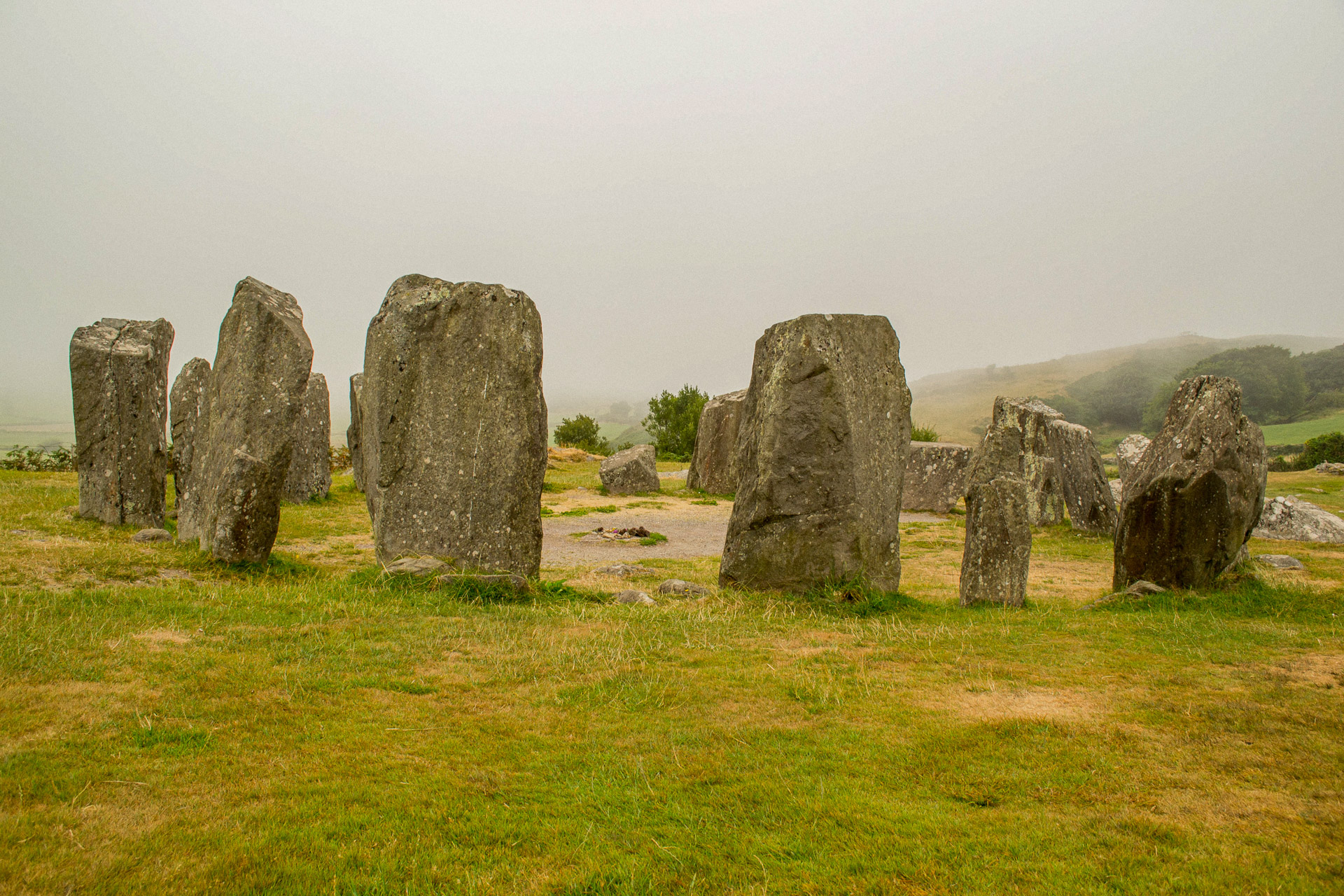
Drombeg Stone Circle offers a short historical stop before the route reaches Long Strand. The beach is well placed for lunch or coffee, with the dunes providing some shelter from the wind.
Continue through Rosscarbery, Glandore, Union Hall and Skibbereen before moving farther west towards Schull, Crookhaven and the Mizen Peninsula. Progress becomes slower as the roads narrow and the worthwhile coastal detours become more frequent.
Mizen Head is the main destination, but it is not a roadside viewpoint. Allow time for the visitor centre, the walk, the steps and the different viewing platforms. The landscape feels especially dramatic when the cloud breaks after rain, although exposed conditions can make the headland feel much colder than the nearby villages.
Check the official opening hours before travelling, particularly outside the main summer season.
Barleycove and the sheltered bays around the peninsula make better places to pause afterwards than immediately beginning another long drive.
Scenic drives
Scenic stops
Walks, activities and beaches
Food and resupply
Overnight stops
Suggested overnight plan
Book ahead during busy periods and check Mizen Head opening hours before setting out. Treat any informal coastal stop as unconfirmed until you have checked current signage and recent local information.
Beara is one of the strongest sections of the route, but it is also one of the easiest to overplan.
Approach through Bantry or Glengarriff and decide whether the day's priority is the coast, the mountains or Ilnacullin, also known as Garinish Island. Trying to combine everything in a single day can turn a memorable stage into a rushed one.
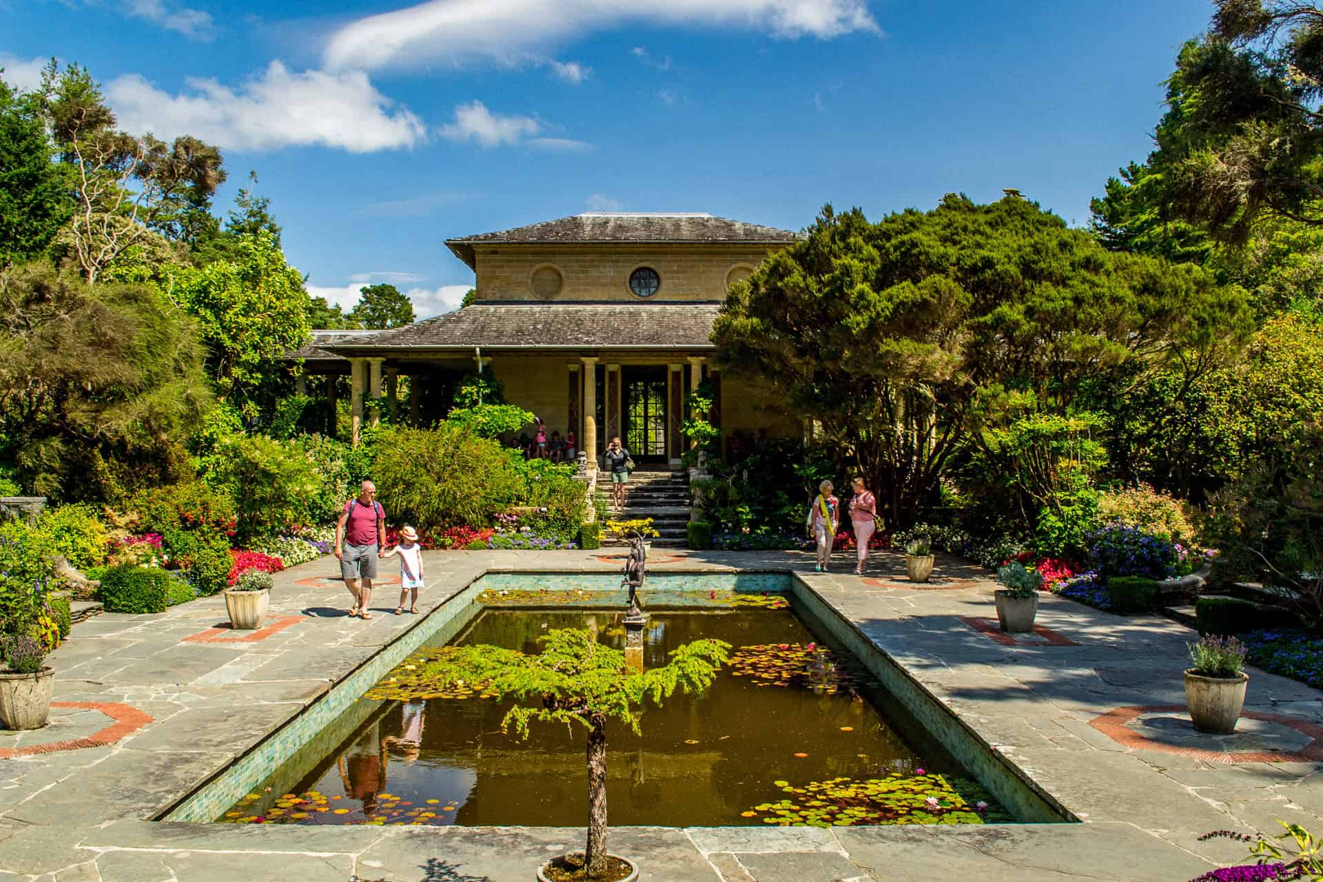
The short ferry crossing from Glengarriff leads to Ilnacullin, where formal gardens, woodland and sheltered planting can feel unexpectedly Mediterranean on a bright day.
Back on the mainland, continue through Glengarriff and Adrigole before climbing towards Healy Pass. The landscape changes quickly from sheltered coastline to bare mountains, glacial valleys and tightly winding roads.
Use the main signed route and avoid minor mountain shortcuts. Roads such as Priest's Leap may look appealing on a map but are not suitable additions to a campervan itinerary.
Allow passing traffic plenty of room and use established pull-ins rather than stopping on narrow bends for photographs.
Scenic drives
Scenic stops
Walks and activities
Food and resupply
Overnight stops
Suggested overnight plan
Killarney is both a destination and a useful reset point.
It provides an opportunity to restock, use campsite facilities and explore several major sights without a long driving day. Muckross House, Torc Waterfall and the lakes sit close together, making this one of the easiest stages to adapt around poor weather.
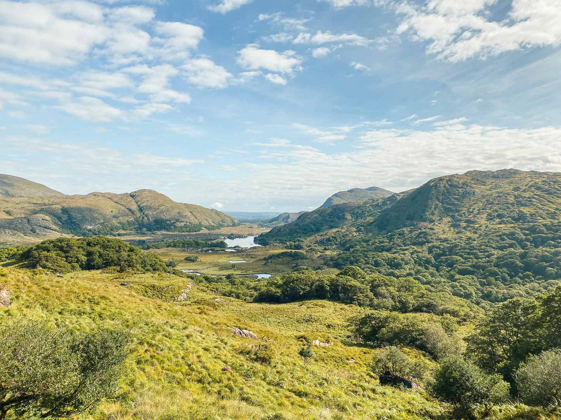
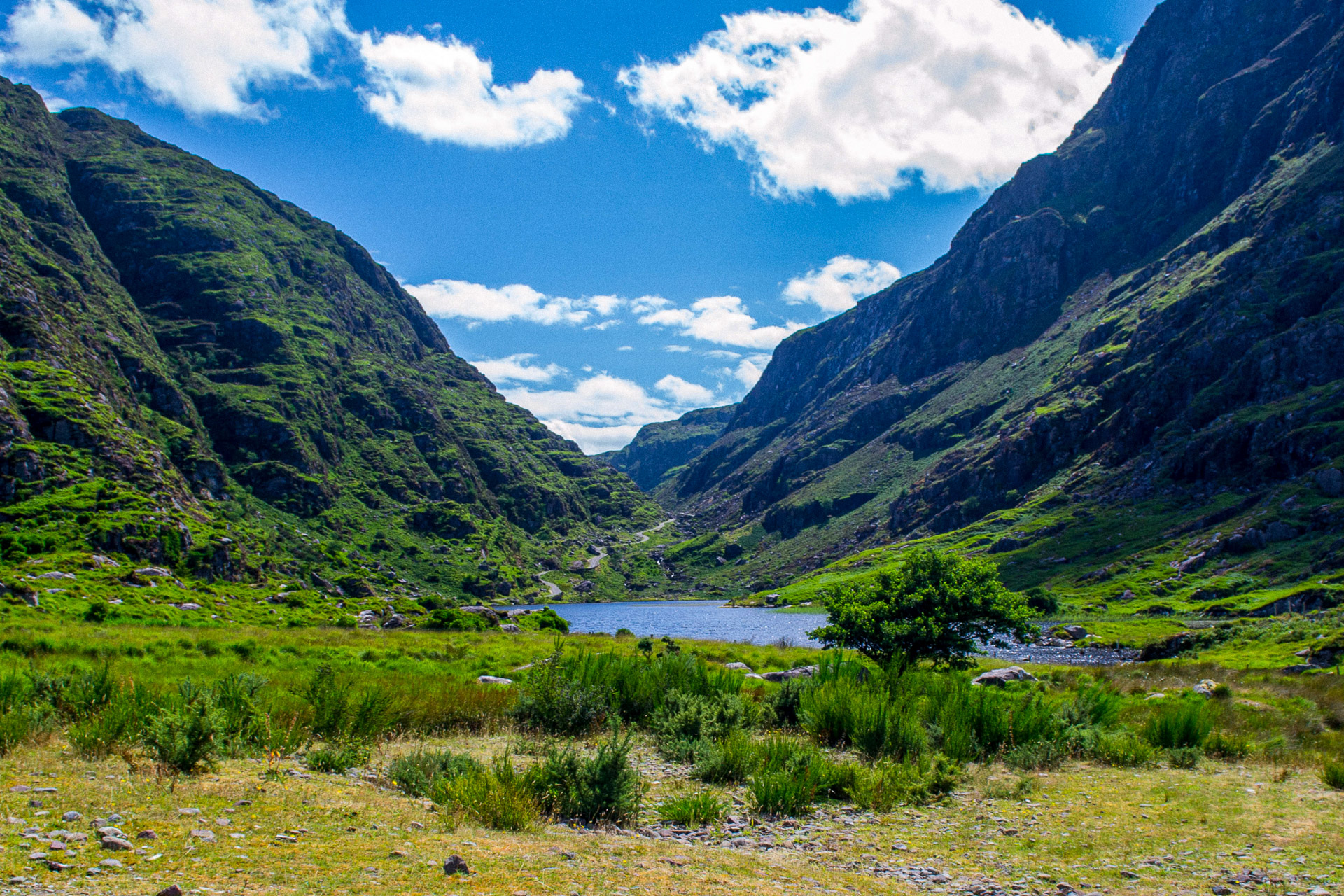
The drive from Kenmare towards Killarney passes Moll's Gap and Ladies View before descending into Killarney National Park. Use the established viewpoints and larger parking areas rather than stopping on narrow sections of the road.
The Ring of Kerry deserves more than a continuous loop behind the steering wheel. Choose a few meaningful stops and leave room for viewpoints, beaches and gardens.
Kells Bay Gardens offers a quieter contrast to the major viewpoints, with dense subtropical planting and a setting that feels far removed from the busier road outside.
Campervans can use the suitable daytime parking areas around Muckross, but overnight camping or parking is not permitted in Killarney National Park car parks. Use an established campsite nearby.
Scenic drives
Scenic stops
Walks, activities and beaches
Food and resupply
Overnight stops
Suggested overnight plan
Approach Dingle through Inch Strand, where the long beach provides space to walk, surf or simply stop before the road continues west.
Dingle town is compact, lively and easy to explore without the campervan. It also makes the most practical base for the peninsula's shops, food and harbour.
Allow a separate day for Slea Head Drive. The scenery changes quickly between beaches, cliffs, small settlements and exposed Atlantic viewpoints, so progress is slower than the mileage suggests.
Conor Pass is not part of this campervan route. Vehicles weighing more than two tonnes are prohibited from using the restricted section northeast of the summit. Follow the suitable signed roads around the peninsula and treat any photographs from the pass as inspiration rather than driving instructions.
Parking can become limited around the most popular Slea Head stops. Start early, use established parking areas and avoid blocking narrow roads or access points.
Scenic drives
Scenic stops
Walks, activities and beaches
Food and resupply
Overnight stops
Suggested overnight plan
Book ahead during the main season. Do not rely on beach parking or informal roadside areas for an overnight stay unless current signage and local information clearly permit it.
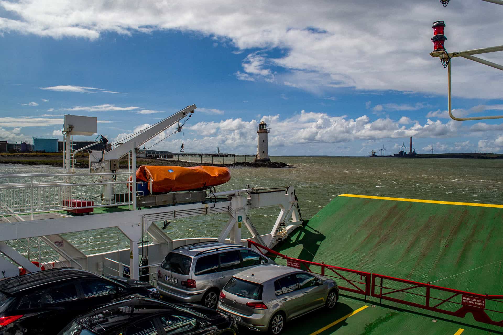
Leaving Kerry by the Tarbert to Killimer ferry keeps the route close to the Atlantic and avoids a long inland detour.
Check the official sailing schedule before setting out and leave enough flexibility for queues, seasonal timetable changes or weather disruption. Do not build the entire day around catching one specific sailing.
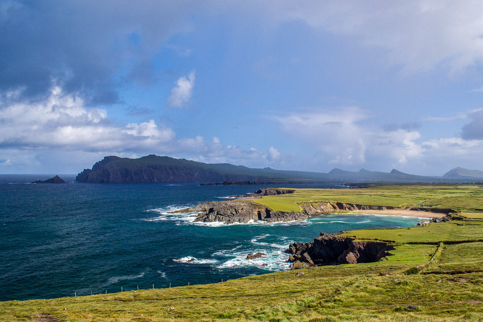
Once in Clare, resist the temptation to drive directly towards the Cliffs of Moher. Loop Head deserves its own stage.
The peninsula is quieter than the major attractions farther north, with open coastal roads, sea cliffs and the Bridges of Ross near its western edge. Kilkee provides a useful stop for food, supplies and coastal walking.
The final roads towards Loop Head become narrower and more exposed. Use the established viewpoints and allow oncoming traffic space to pass.
Scenic drives
Scenic stops
Walks, activities and beaches
Food and resupply
Overnight stops
Suggested overnight plan
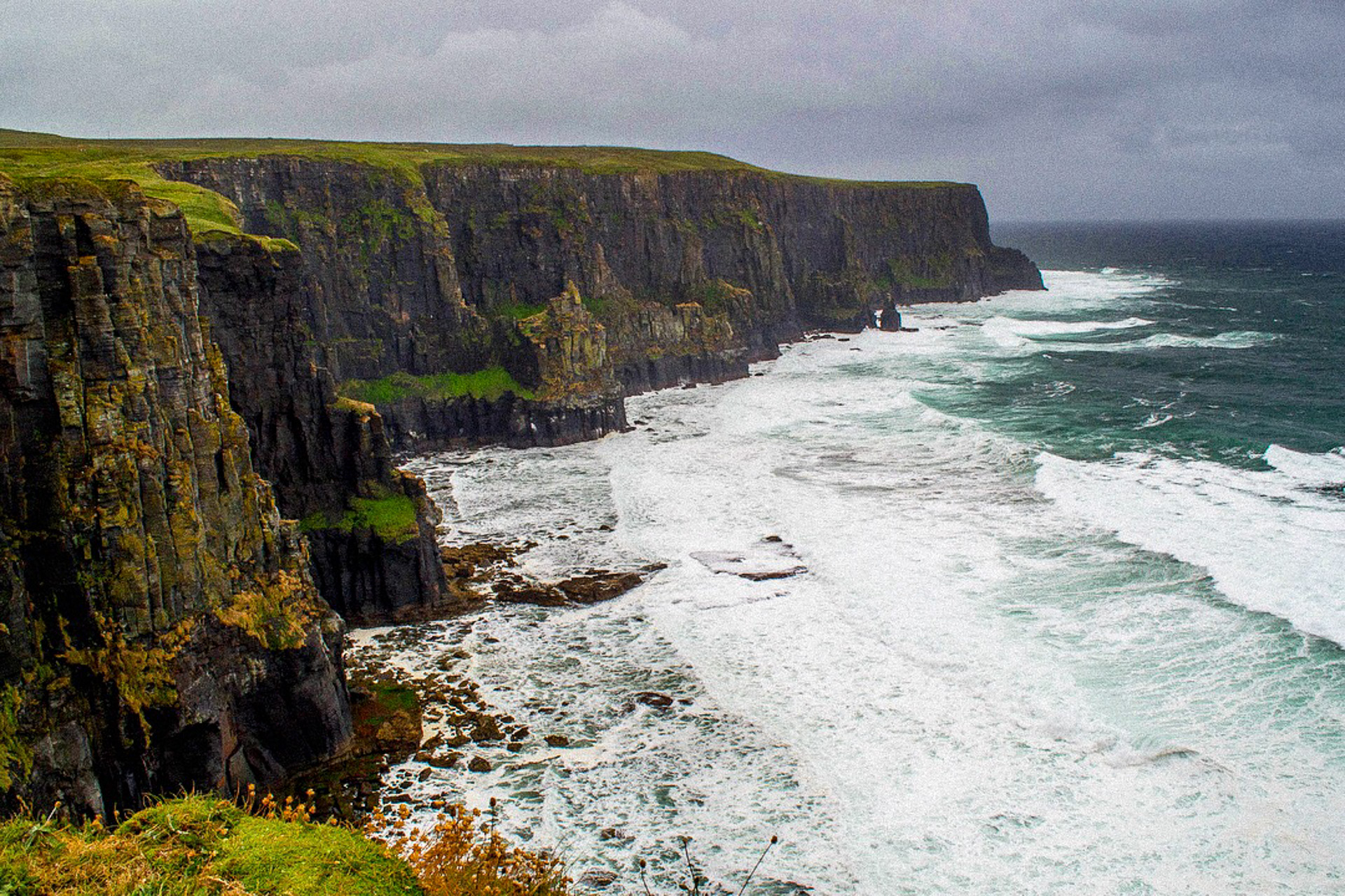
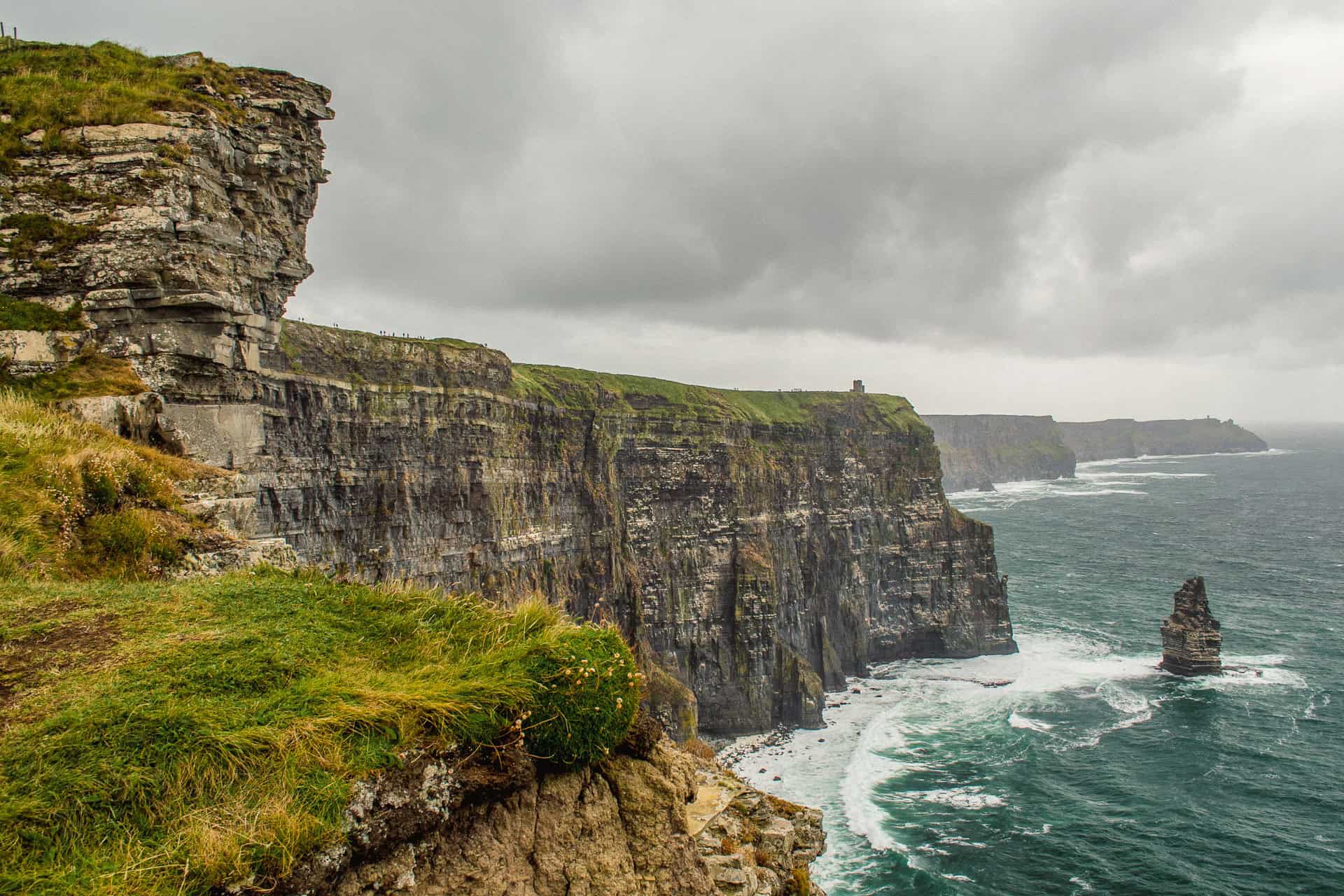
Approach the Cliffs of Moher as a weather-dependent stop rather than a fixed photograph.
Cloud and mist can remove the view completely, while breaks in the weather can transform the cliffs within minutes. Check the current coastal-walk status before travelling and use only sections officially marked as open.
The main visitor experience can be reached by road. Do not assume that a continuous coastal walk between Doolin, the visitor centre and Hags Head is available, as sections may be closed for safety work.
Continue north through Doolin and into the Burren. This is a landscape that becomes more interesting when explored slowly. Stop, walk across the limestone pavement and look for fossils, fissures and small areas of vegetation rather than viewing it only through the windscreen.
The road through the Burren can feel exposed and empty, but villages, cafés and the Galway Bay coastline are never far away.
Continue towards Galway in the evening so the final overnight is close to the city and the following morning can remain relaxed.
Scenic drives
Scenic stops
Walks, activities and beaches
Food and resupply
Overnight stops
Suggested overnight plan
Overnight campervan parking in Galway's public car parks should not be assumed to be permitted. Use an established campsite or another explicitly authorised facility.
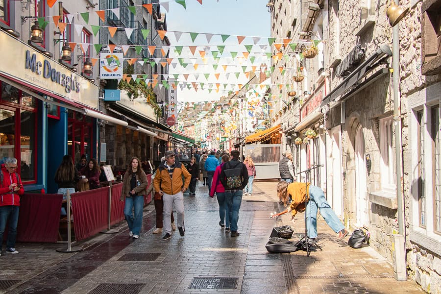
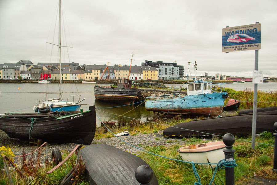
Galway provides a natural end to the southern coastal section.
After days of smaller roads and isolated headlands, the city feels busy and energetic. Park outside the tightest central streets where possible, then explore the harbour, the Latin Quarter or Salthill on foot.
Keep the morning focused rather than trying to fit in a full day of sightseeing. A short walk through the Latin Quarter, around the Spanish Arch or along Salthill Promenade gives you time to enjoy the city before beginning the return to Ballymoney.
Leave by approximately 9:30am and follow the main route north through Sligo and Enniskillen. Allow additional time for traffic, fuel and meal stops, particularly around Sligo and the border counties.
If the schedule is running comfortably, Benbulben or Drumcliffe can provide one final scenic break without creating a major detour. Avoid adding a longer Connemara extension to this 14-day itinerary, as it would leave insufficient time for the return journey.
Return the campervan at the agreed time with fuel, waste and personal belongings dealt with according to Karen & Co's collection and return instructions.
Galway morning
Parking and practical information
Food and resupply
Optional return stops
Return plan
Have more time to continue along the coast? Our 7-day Wild Atlantic Way campervan route covers Connemara, Mayo, Sligo and south Donegal before returning to Ballymoney.
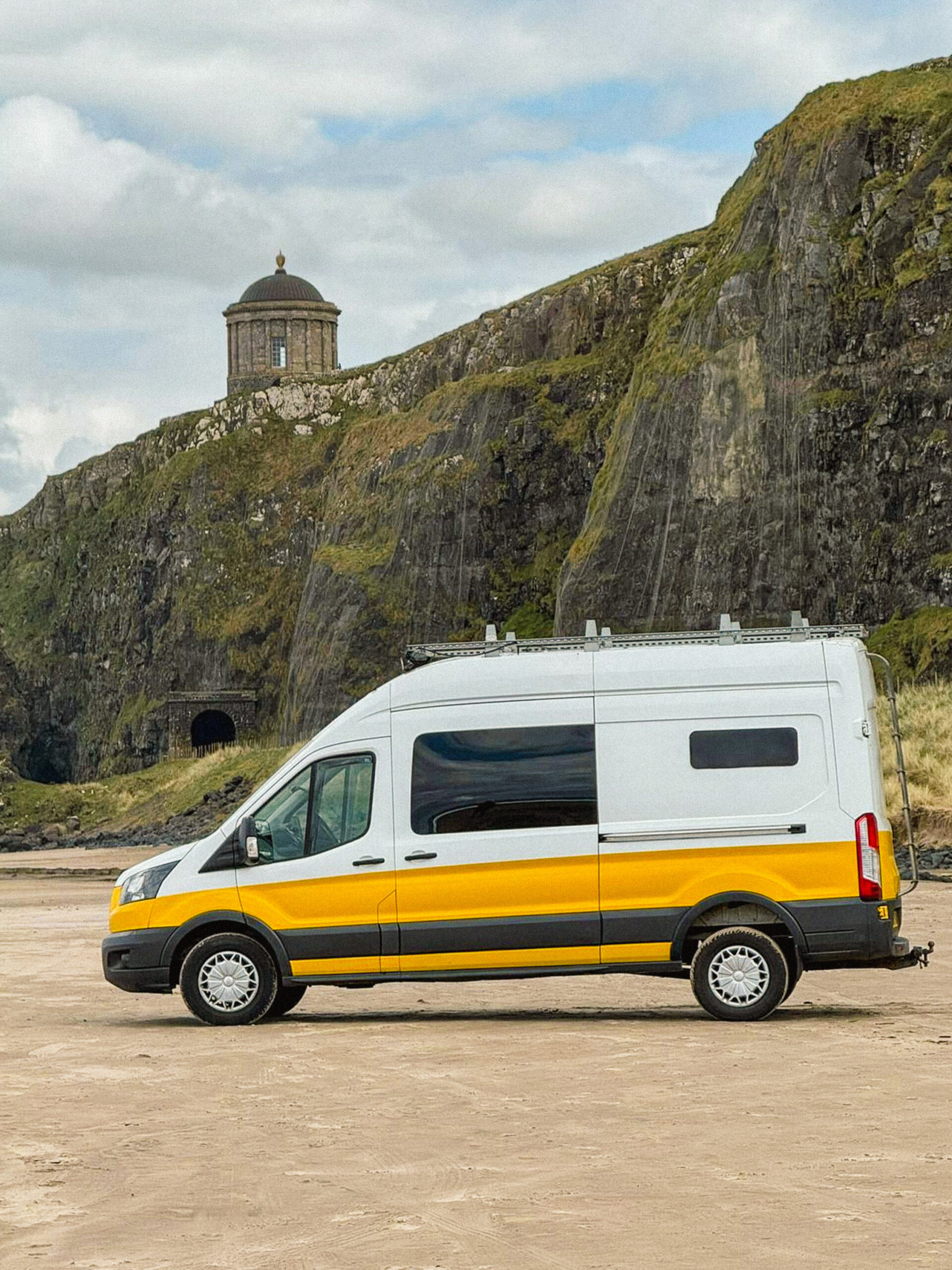
For this longer Wild Atlantic Way route, choose one of Karen & Co’s Premium campervans. They include unlimited mileage and can travel throughout the island of Ireland, giving you the flexibility needed for this 14-day journey.
Kodi is a comfortable choice for couples, Keeva provides an additional bed for a third traveller, and Kerry offers the extra space needed for families or larger groups.
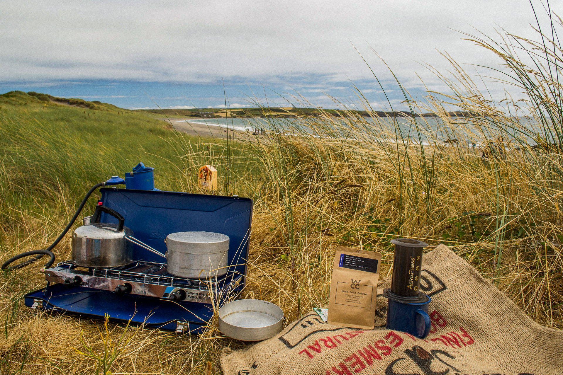
The southern Wild Atlantic Way is not defined only by its major landmarks.
Some of the best moments happen between them: coffee behind the dunes, lunch overlooking the sea, an unexpected garden, a waterfall after heavy rain or a quiet beach discovered along the coastal road.
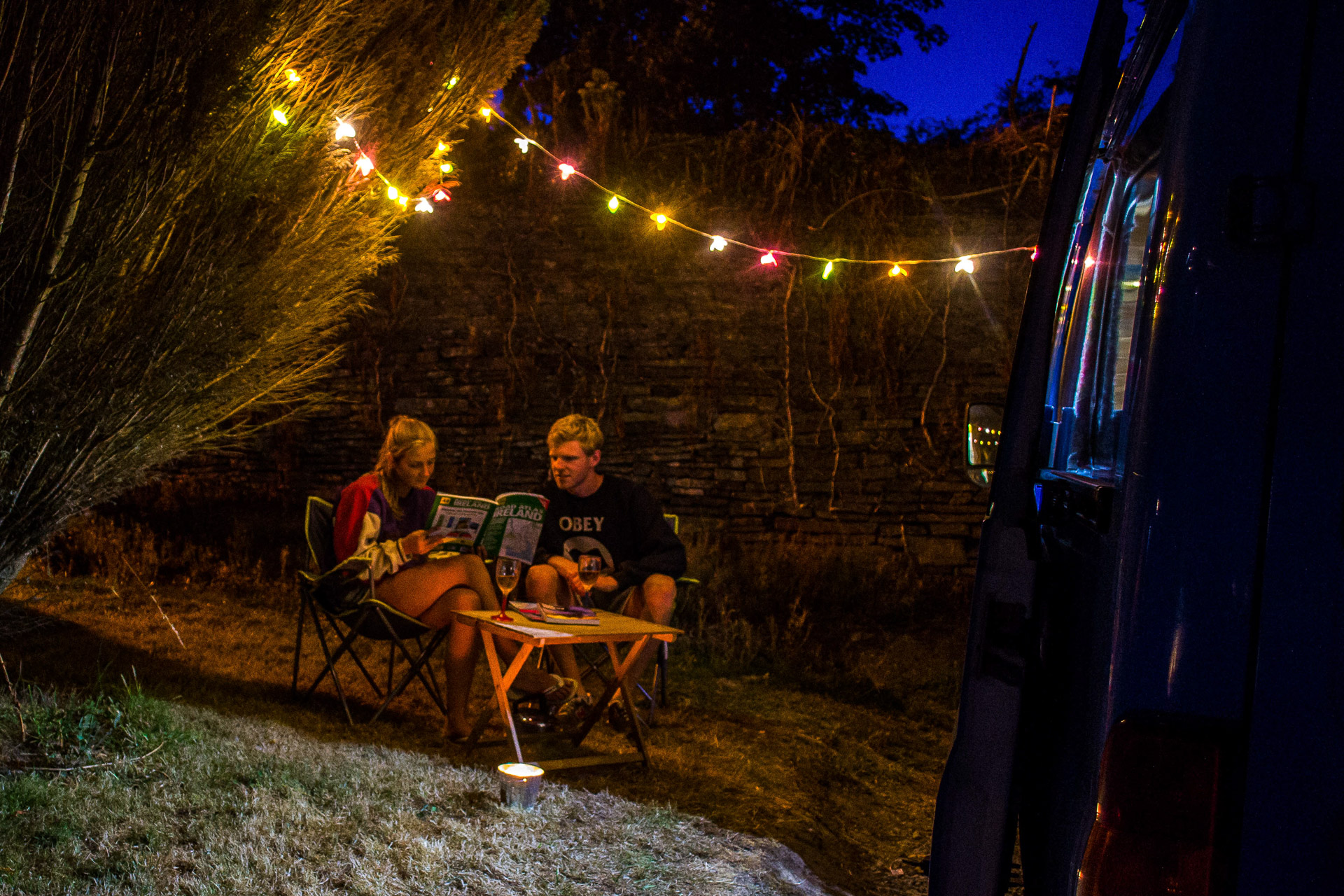
Travelling by campervan makes those moments easier. You can adjust the route around the weather, spend longer in places you enjoy and continue to a new overnight stop without returning to the same accommodation.
Keep the schedule flexible, respect narrow roads and local communities, and allow the coast to set the pace.
Looking for a shorter trip or a different part of the country? Explore 5 of the best campervan routes in Ireland for more ideas from the Causeway Coast to Cork and Kerry.
Site by Verosia Studio
Site by Verosia Studio